

Why maps (and walking) open up your world
'There are no uninteresting things, only uninterested people.'

I have spent the summer and autumn doing a lot of walking.
Some walks have been for leisure and fresh air — a circuit breaker from a day job full of screens or getting from A-B. Other walks (hikes) have been for exercise and daily activity, involving distances, hills and maybe a rucksack full of sustenance and equipment.
Some of those blissful walks this year have been meandering with no specific purpose or destination, other than to get outside and see where my legs take me, which, I have realised, is not something most of us do very often (or ever?). But, as someone who always has a plan and a destination in mind, it has been enriching and satisfying to slow down and go with the flow and see where I end up.
Other walks, however, have been more purposeful and specific — a loop or point-to-point with a plan, criteria and points to find along the way. I recently started walking a 98-mile trail in Cumbria, which I may share in another edition once I’ve finished the final two days.
Some people ask me if it’s boring spending many hours walking on my own (or with the dog). I would say it’s more interesting than running since you see a lot more and spend more time immersed in your surroundings, noticing things you wouldn’t if you ran past.
It instantly makes me think of the phrase:
“There are no uninteresting things, only uninterested people,” (G.K. Chesterton).
Also, depending on your route, the terrain and surroundings will likely change so frequently that there’s always something new to take in. But, as my friend told me this week, that’s not so important for some people.
Andrew Bowness recently set off walking on the canal from Kendal and ended up walking 27.5 miles to Lancaster. When I congratulated him on his madness, I asked if he got bored with the unchanging terrain. He said:
“Embracing boredom and ‘the trudge’ was kind of part of the challenge. Since it’s flat, you know exactly what is coming for 10 hours; there’s no tough section, no rest section, it’s all the same.
“I also didn’t listen to any music or anything, which I’m sure some people would think is crazy. I enjoy long swims, though, so it’s probably similar in that a long swim is mostly the same thing for several hours with just your mind for company.”
Next year, he said he wants to walk the 51 miles of the Lancaster canal, starting from Preston, walking home to Kendal.
How often do you look at a map of your local area?
I have been short of days off to go on longer or further afield hikes, swims, runs or excursions this year, but I have found a little hobby (obsession?) which kept me occupied across the summer, which is great fun and has become shockingly addictive.
In lockdown, the term ‘micro adventures’ was used for similar kinds of local excursions, and they are just as fun as going on a big day out.
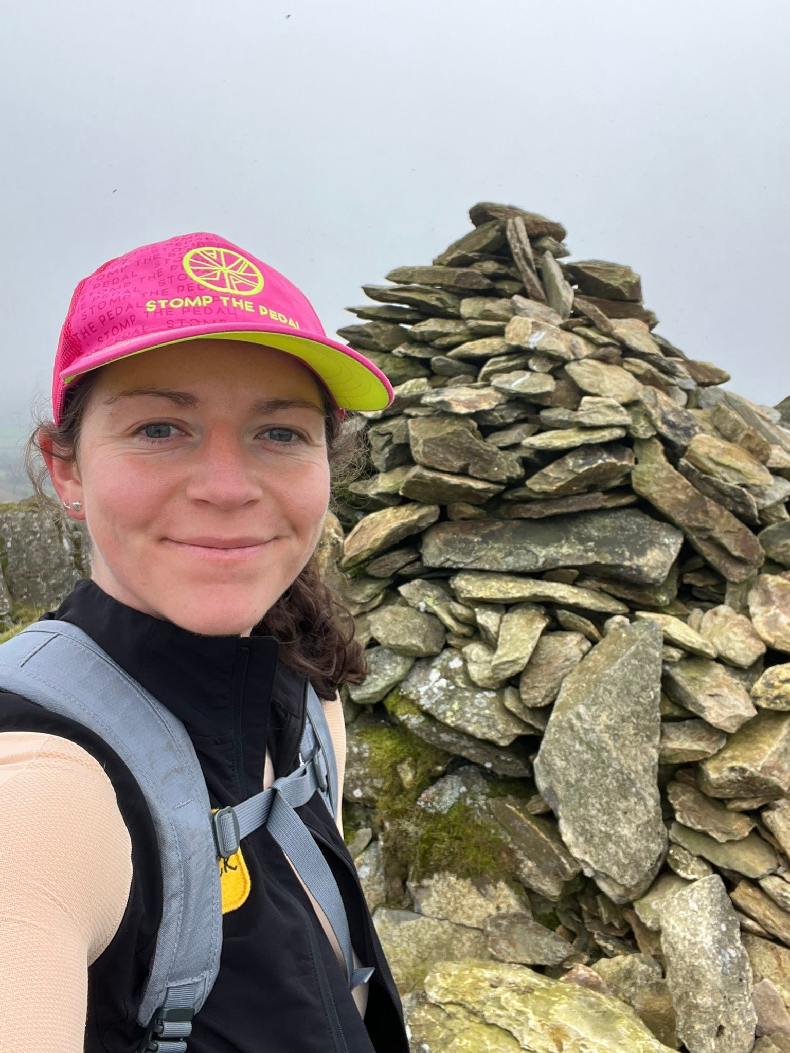
Since I spend a large amount of time nerding out with maps anyway, I decided to study them and pick some local spots I haven’t been to (local say, within 20 miles or a 30-minute drive), be it a trig, a summit, a path/byway, a folly or a place on a map I haven’t been to and visit it.
I’ve lived in this part of North Lancs/South Lakes for most of my life, and I thought I’d more or less been everywhere collectively by bike, on foot, in the car or some remote swimming location, but this little hobby taught me how wrong I was.
When you remove the requirements of specific distance/speed/time/elevation/terrain, and just go with a grid reference to find, it suddenly opens up your world in a whole new way. And it’s fun.
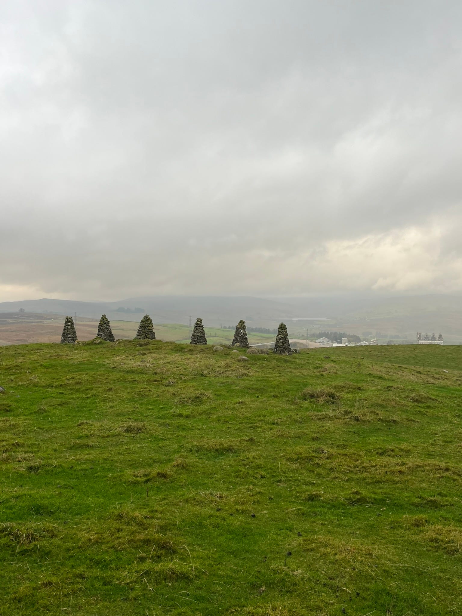
The shortest one I did was 0.75 miles in 30 minutes, wading through a jungle trying to find the long-forgotten, camouflaged trig tucked away in the bracken, brambles and mushrooms growing out of rotten tree branches.
Others have been a bit longer and more pleasant, through fields, on unused footpaths with views most people haven’t seen before because ordinarily there’s no reason to go to some of these places unless you’re a farmer and it’s your land.
Also, if you like trigs, you don’t always need to be on top of a hill to bag one; there’s plenty on the coastline and in fields (but make sure it’s publicly accessible land!).


If you like the data and tracking side of this, there’s a collection of different apps. Summit Bag is one, Strava heatmaps, or for cyclists: ‘tile bagging’ on VeloViewer (1km squares covering the whole world). But if you don’t want the tracking data, you could create a mental heat map and have the permanent fulfilment of knowing that you have set foot in all those places.
There is great satisfaction in visiting obscure spots or places of no real significance, just to stand there and see what the view looks like from the other side. Almost always, you’ll have found something interesting to learn about — a historic plaque, an information board, or perhaps had some interactions with wildlife.
Sometimes I’ll visit a “ruin” as it’s marked on a map that is no longer there, or is buried underground. Ruins come with a special kind of anticipation of what state it will be in. Some are surprisingly habitable, while others require you to bend your imagination to visualise what it used to be and imagine Romans living there. Occasionally, you get a disappointing one, but most of the time you’ll end up finding something you weren’t looking for.
There’s also the delight in visiting places you drive past all the time, not only to see it from a different perspective, but also that one day you made the extra effort to get up there and look down, rather than wonder and never find out.
You never look at a place the same after you’ve been to it.
I’m interested to hear about other people’s walking adventures (long or short), and anything they learned or picked up from it. Leave a comment or reply to the email.
Further reading:
From Steel City to Cottonopolis: New walking trail through the Peak District - The Guardian
Stop Counting Steps: Track minutes walking instead, according to a study - Outside
Henry Todd obituary: Insouciant LSD kingpin who was caught in the drug bust Operation Julie and later became a leading supplier of oxygen at Everest base camp - The Times
Strength training may prevent neural decline, according to a study - Outside
Olympic champion Ariarne Titmus retires at 25: “A really tough one, but one that I’m really happy with. I love swimming, but I guess I’ve taken this time away from the sport and realised some things in my life are just a bit more important to me now than swimming.” - ESPN
I love browsing maps. We're incredibly lucky in the UK to have OS maps as the details and notation is fantastic. What's also great is large scale maps of local areas. They go to 1:5000 and also orienteering maps are incredibly descriptive if you can read them well. I really enjoy identifying unusual map features and then visiting them and I often combine map use with satellite images to get a deep understanding of how land use.
Acquiring a greyhound when we retired has made us get up, get out and expand our social circle. Not long after retiring we moved to a new home in the area, nearer to the local town. On our walks we have discovered many new places. We have walked regularly for many years and the pleasure of discovering something new and different is immensely satisfying. Walking allows you to discover these places.
We have met so many lovely people during our dog walks. Some we see frequently to say hello to, some we stop and catch up on our dog's vagaries and problems (as well as our own). Some, old and young, have become wonderful friends and dogsitters!